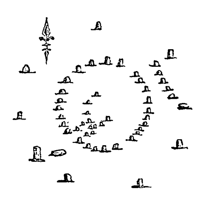
Archaeologia Scotia, 3. p.212-3, 1831.

This is Anderson's plan
drawing of Kinchyle of Dores made from his visit in the 1820's.
In his paper,
Anderson mentions that nine circle stones were still standing during his visit,
but his diagram only
shows eight.
The fallen eastern stone is accurately portrayed and we presume the fallen stone
at the SW might
actually be
the large outer kerb stone in this rough location.
He shows the SW stone as the tallest, which is accurate, but there are two
stones shown between the southern
and eastern stones which are not present today. The northern stone appears to
have been erect during his visit
and there is currently no trace of the strange stone row shown between the
eastern and north-eastern stones.
Proceedings of the Society of Antiquaries of Scotland, 16, p.491-2, 1881-2.

Beaton Includes Kinchyle
(the stone circle at Scaniport) in
his survey of the antiquities of the Black Isle almost as an afterthought,
suggesting
its use for comparison with Black Isle monuments. He gives no details in his
paper apart from the location.
The plan of the cairn matches modern accounts well but the surrounding circle
is, once more, at odds. The northern stone
is shown erect, as in Anderson's plan, but the southern is depicted as fallen,
at odds with Anderson and our observations.
There is also an extra stone with highly anomalous spacing at the NNW.
The two fallen stones at
the SE correspond well to the two shown here erect in Anderson's plan
although there is nothing at this location today. The odd stone row at the NE is
once again depicted.
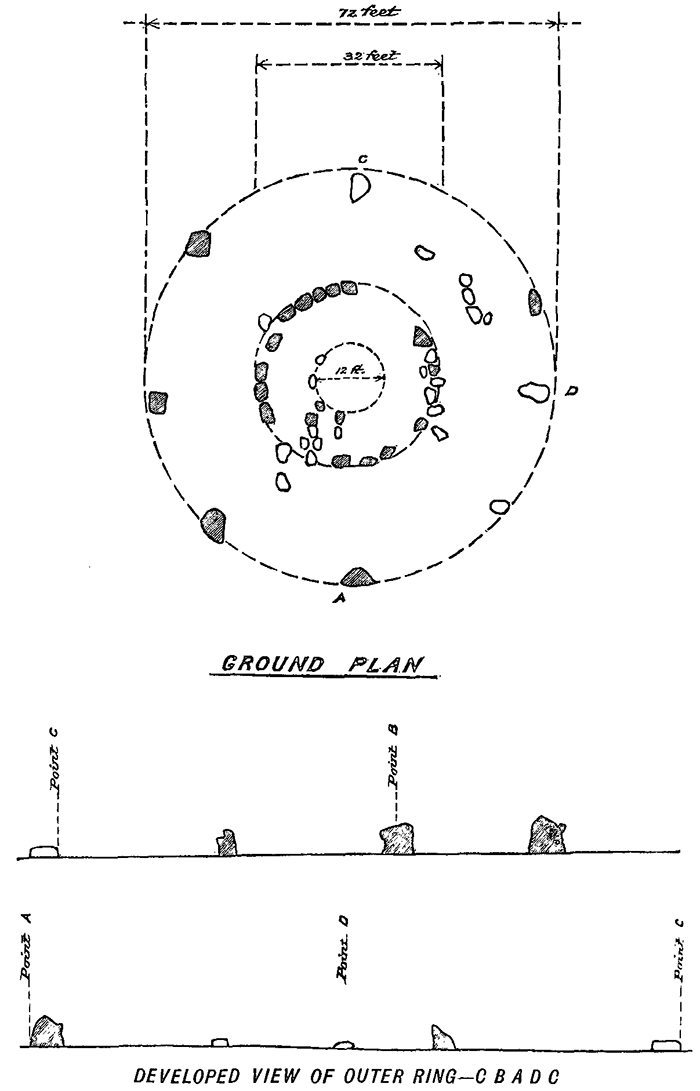
Proceedings of the Society of Antiquaries of Scotland, 18, p.357, 1884.

Fraser's plan fits well
with modern diagrams and agrees generally with our viewing of the site, although
the
odd row of stones at the NE is again shown. This feature is not in modern plans
and the area in question
was buried in the dreaded gorse-rich undergrowth during our visit, and thus
could not be inspected.
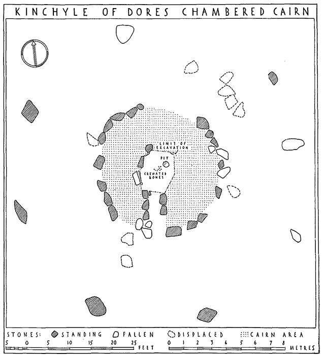
Proceedings of the Society of Antiquaries of Scotland, 88, p.185-7, 1956.

Piggot's plan fits best
with our viewing of the site although some fallen stones, presumably kerbs,
around
the passage entrance were not present during our visit and are not shown in
Henshall's diagram. Also
missing from Henshall's plan is the fallen stone at the SE, we could not find
this either, but the massive
gorse-rich undergrowth could easily have concealed it.
As usual, our sincere thanks to the Society for allowing use of material from its most excellent Proceedings.